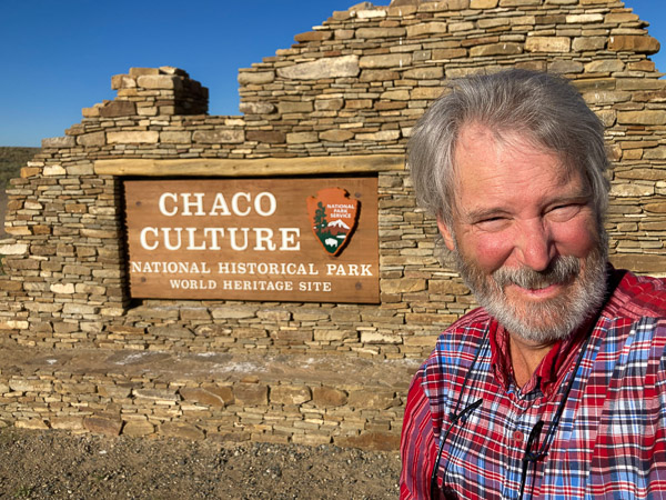
After braving the nearly washed out road from the north I arrived around 9am. I had to “walk” my Prius diagonally over piles of gravel and exposed rock faces. This was my third attempt over twenty years to visit this important site. (The first two failed because the roads were completely washed out!) [Full Gallery]
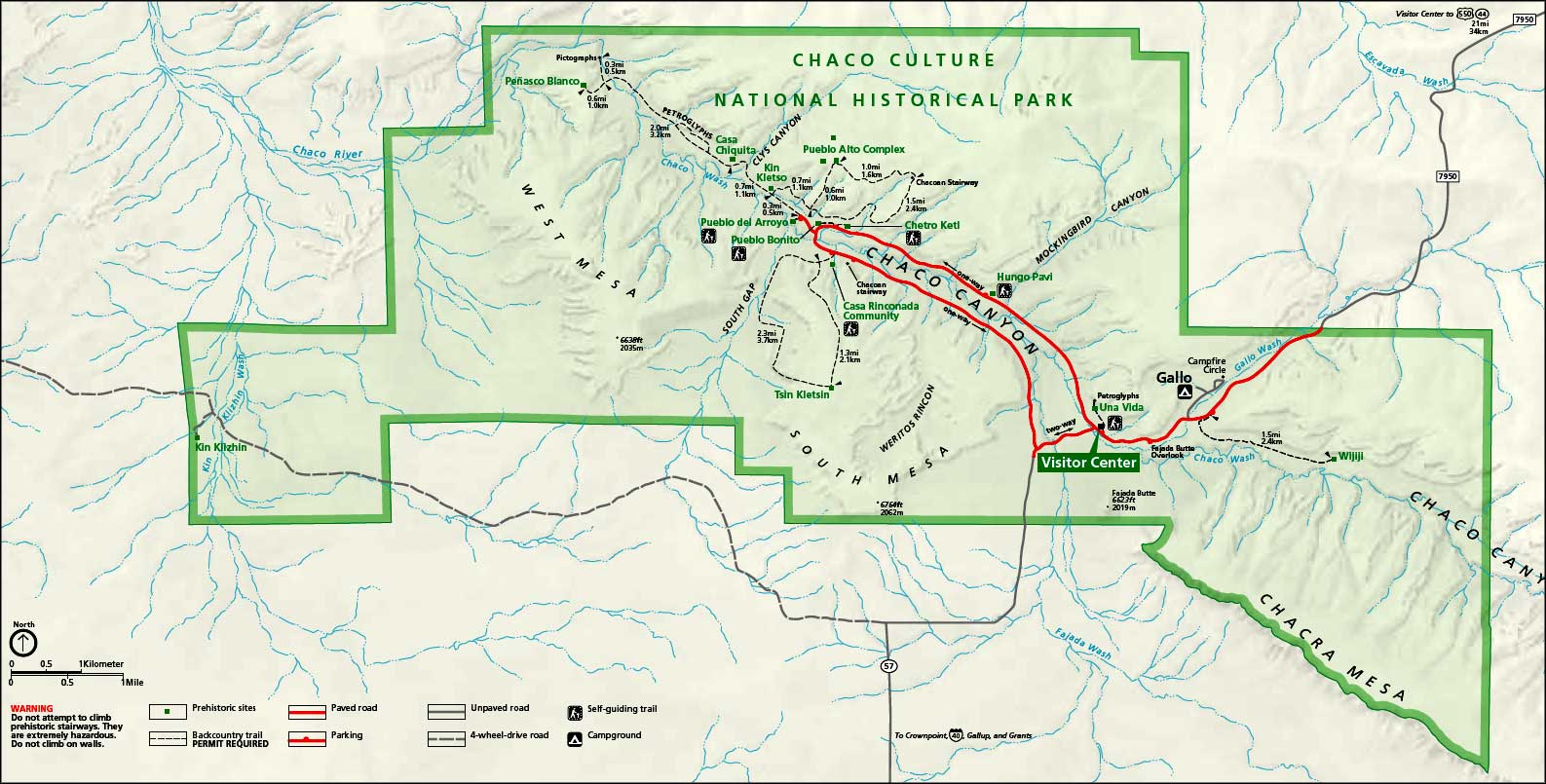
The map below shows the basic layout of the park (click to enlarge). Most of the sites are easy walking distance from the main loop drive.
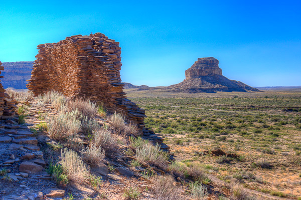
A short walk from the Vistors Center is the small un-excavated ruins of Una Vida. The prominent Fajada Butte is seen in the distance. This is the location of the famous “Sun Dagger” astronomical feature presumed to mark the summer solstice.
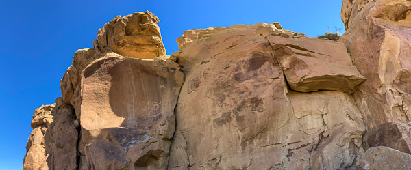
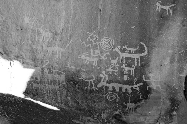
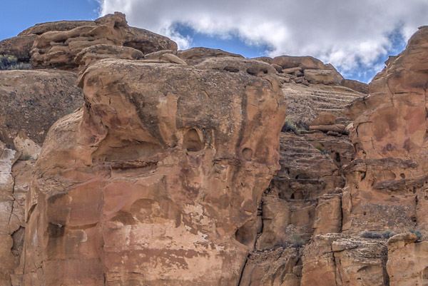
A short scramble above that are impressive Petroglyphs inscribed into the cliff face.
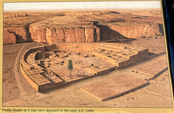
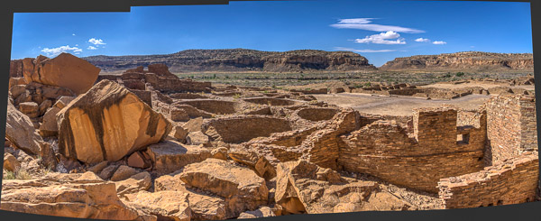
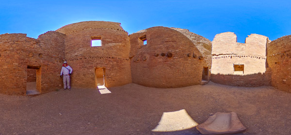
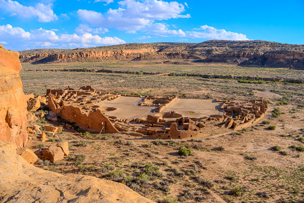
The focal point of the entire park is Pueblo Bonito, a huge stone edifice that contained over six hundred rooms and dozens of circular ceremonial structures called “Kivas”. (source:nps sign)
The walls nearest the cliff were crushed by a rock slide after the structure was abandoned. The rounded walls are the remains of various kivas.
One quadrant has been restored so visitors may explore a warren of small rooms. Notice the very low doors and what remains of wooden timbers holding up the floors above. The stone in the foreground was used to grind corn. The consensus is these rooms were not residential but related to the ritual use of the site.
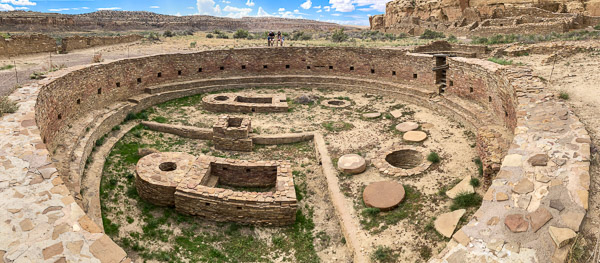
The nearby ruins of Chetro Ketl features a Great Kiva 62 feet in diameter. Notice the two seated visitors for scale!
The remains of Chacoan Stairways can be seen in several places behind the ruins. These are no mere “Moki Steps” but wide grand staircases leading to cerimonial roads throughout the area.
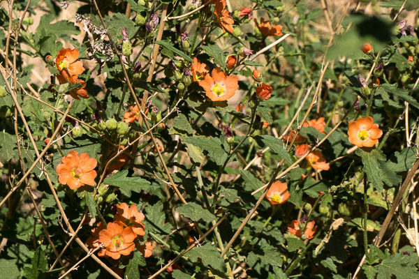
Several flowering plants were abundant due to recent rainfall. This particularly showy example is Emory’s Globemallow.
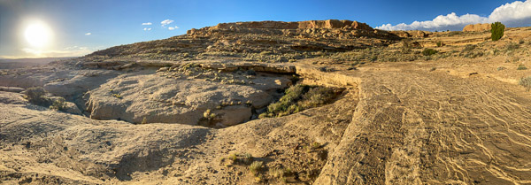
The Pueblo Alto Trail starts above the Kin Kletso ruins. I attempted this late in the day after finding out there were no more campsites available that night. The trail went straight up into a huge crack in the rock!
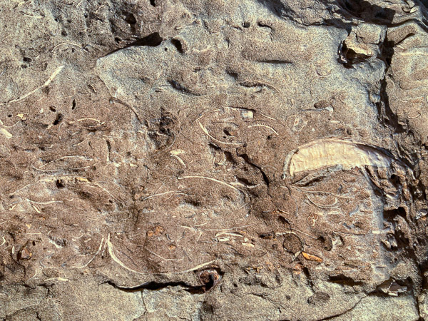
As I was ascending I noticed one boulder that was different then all the others. It had Fossils! Mostly cross-sections I thought. Here is what some online geologist friends speculated…
“Mostly cross-sections of fossil shells, mostly bivalves & I think a gastropod.”
“…the large white mass consists of opaque secondary calcite that precipitated in an empty shell post-deposition, in contrast to the others that filled with silt or lime mud shortly after death.”
I climbed about two hundred feet to the stone rim.
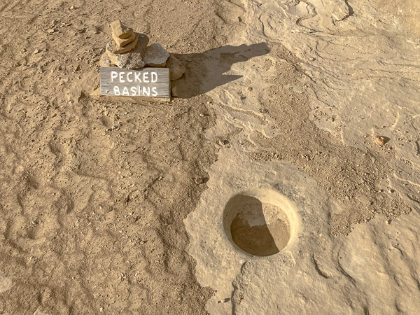
There were helpful signs along the way, including this one calling attention to several man-made basins pecked out of the rock where water would sometimes flow.
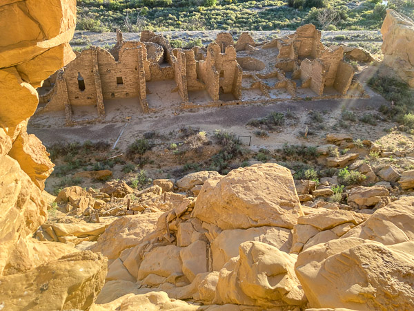
I finally got to the overlook where you could survey Pueblo Bonito in all its glory!
At that point I had to turn back and start my downward climb… (Alternate Video)
Note: The trail went through a huge crack in the rock face. I used a Theta S 360 Camera to capture my descent. At one point I was also fighting a 20+ mph headwind! It looks very steep at the end… IT WAS!
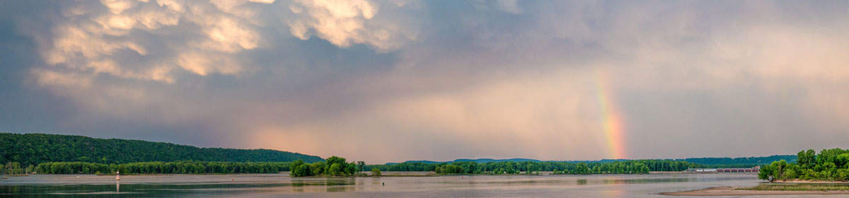
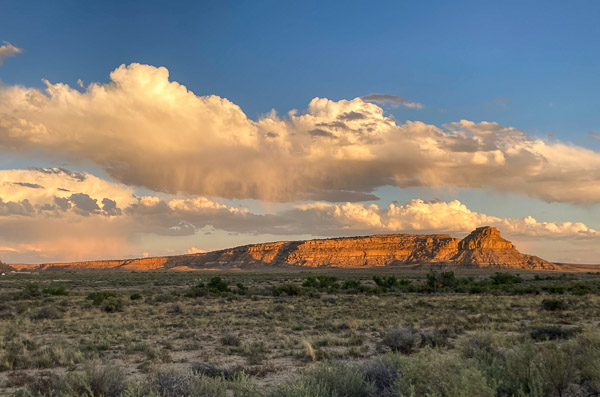
I ate dinner as the setting sun lit the virga falling from late afternoon clouds.
What I missed…
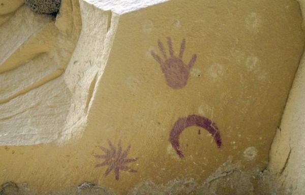
I did not have time for the seven mile hike to see the Supernova & Comet Pictographs near the Penasco Blanco ruins (picture shown here from Wiki Commons). The “starburst” figure may document the 1054 CE Crab Nebula Supernova.
I left the park at dusk via the south entrance road. Fortunately this route was in better shape and the main hazards were multiple tall cattle grates that threatened to high center my car.