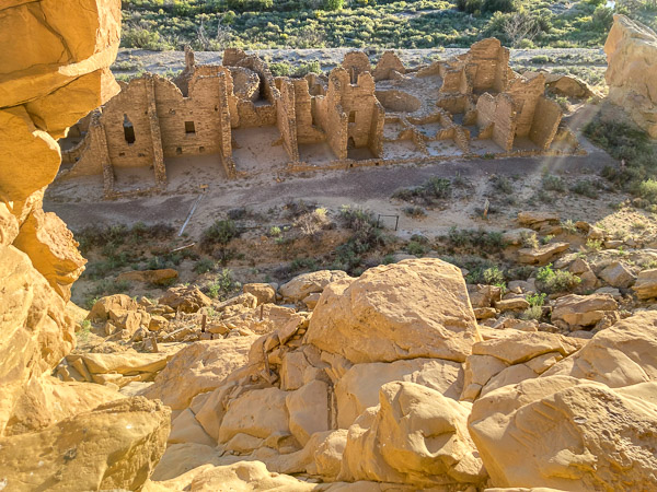
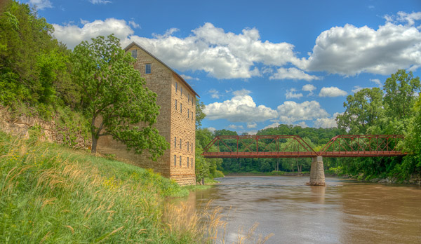
The Town of Motor with a large gristmill took shape in the 1870s along the Turkey River in Clayton County Iowa. Nothing remains of the town itself, but the mill and associated buildings survive. The Mill is situated at a narrow bend in the Turkey River. It was built of limestone quarried from the nearby cliff top and oak from the surrounding forest. [Full Gallery]
At that time the major crop grown locally was Wheat (almost none today)–and wheat must be ground into flour in order to sell it. With this in mind, the partners built a state-of-the-art mill and the infrastructure to support it.
The Site
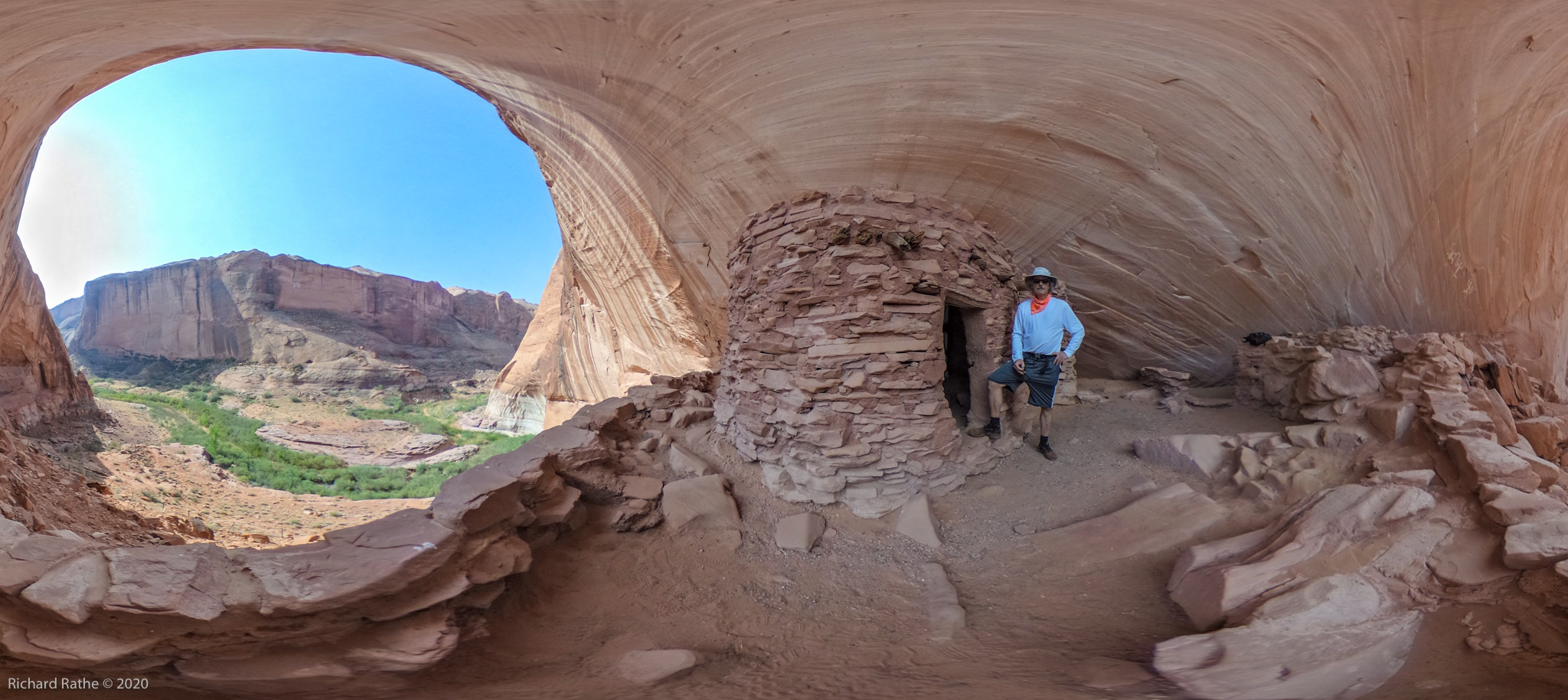
The Motor Mill site is picturesque to say the least. This drone photograph from motormill.org shows the five remaining stone buildings. From left to right they are: The Stable, The Inn, The Smokehouse, The Mill, and the Cooperage. The town itself was to the right and part of that area is now a public campground. The Inn has recently been reopened with a gift shop and overnight accommodations.
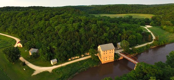
Farmers would come in horse-drawn wagons with their crop. After unloading the farmer would stable his horses and take a room at the inn. Bulk flour was typically shipped in wooden barrels and these were produced locally by the cooperage.
Inside
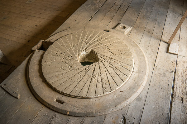
After the business failed, the property was sold and the mill became a barn. As such, much of the internal machinery was sold off. One notable exception are the four grindstones. These are embedded in a raised platform that is structurally isolated from the rest of the building. When the mill was operating, four companion stones weighing hundreds of pounds each would spin at 90rpm on top of these fixed stones to do the grinding. Apparently this generated lots of noise and vibration!
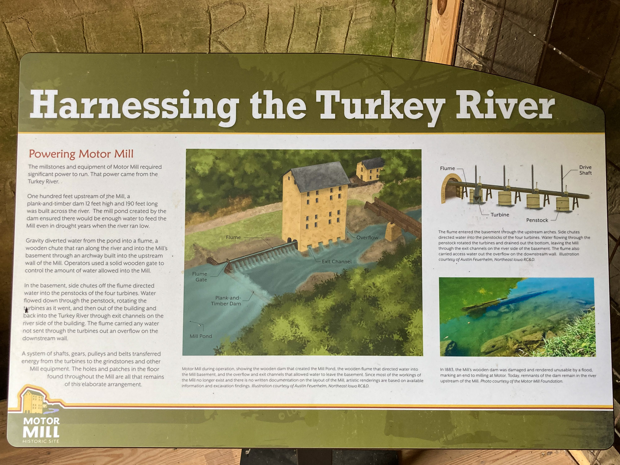
Operationally the mill relied on gravity to do much of the work moving product around. This schematic captures most of the complexity (click to enlarge).
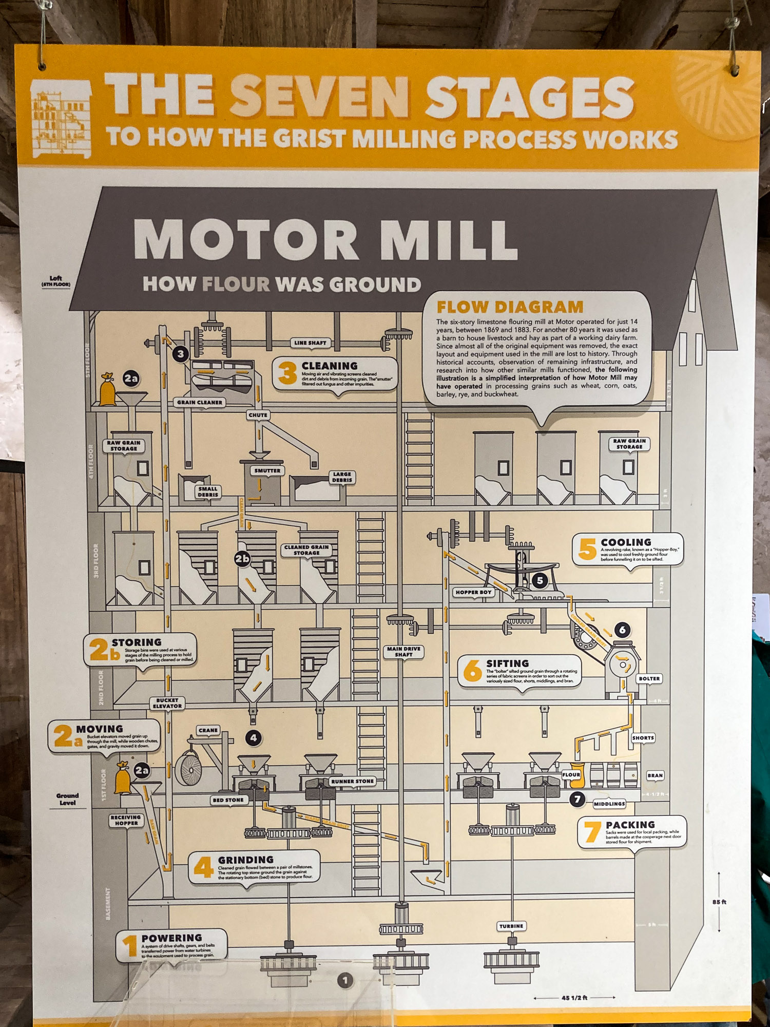
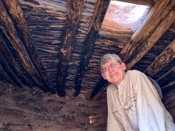
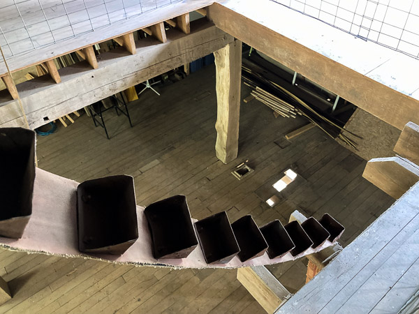
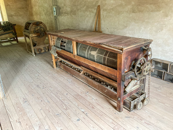
There were a series of “elevators” (similar to the belt shown below) that would bring materials to the upper floors. (Also note the 12×12 inch solid oak beams used in construction!)
The grain or unfinished flour would then fall through a series of separator and cleaning machines. The site has recently obtained antique equipment similar to that used in the original mill. The apparatus in the foreground is labeled “Flour Dresser”.
Recent Discoveries
The Mill was derelict until very recently. A non-profit foundation is now in charge of preserving and making it available to the public. Great progress has been made in the past two years. In particular, the huge vaulted basement was mostly unexplored due to twenty feet of river mud deposited there by frequent floods. Volunteer excavators and archeologists “dug in” to find out what lay below all that mud.
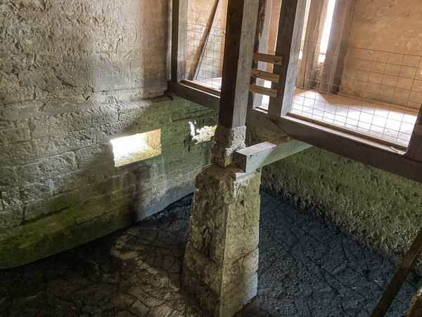
In the photo above the mud has already returned to a level above the outlets to the river. The rectangular openings on the left are overflow ports. The power for the mill came from vertical water turbines. This is a more efficient design than the classic waterwheel. On the lower right is one of the vertical shafts transmitting power from the turbine below.
It was thought, and some illustrations still show, that there were three turbines. However, it became clear during the excavation that there were four. Not only that, these were not made out of steel, but crafted from the local oak!
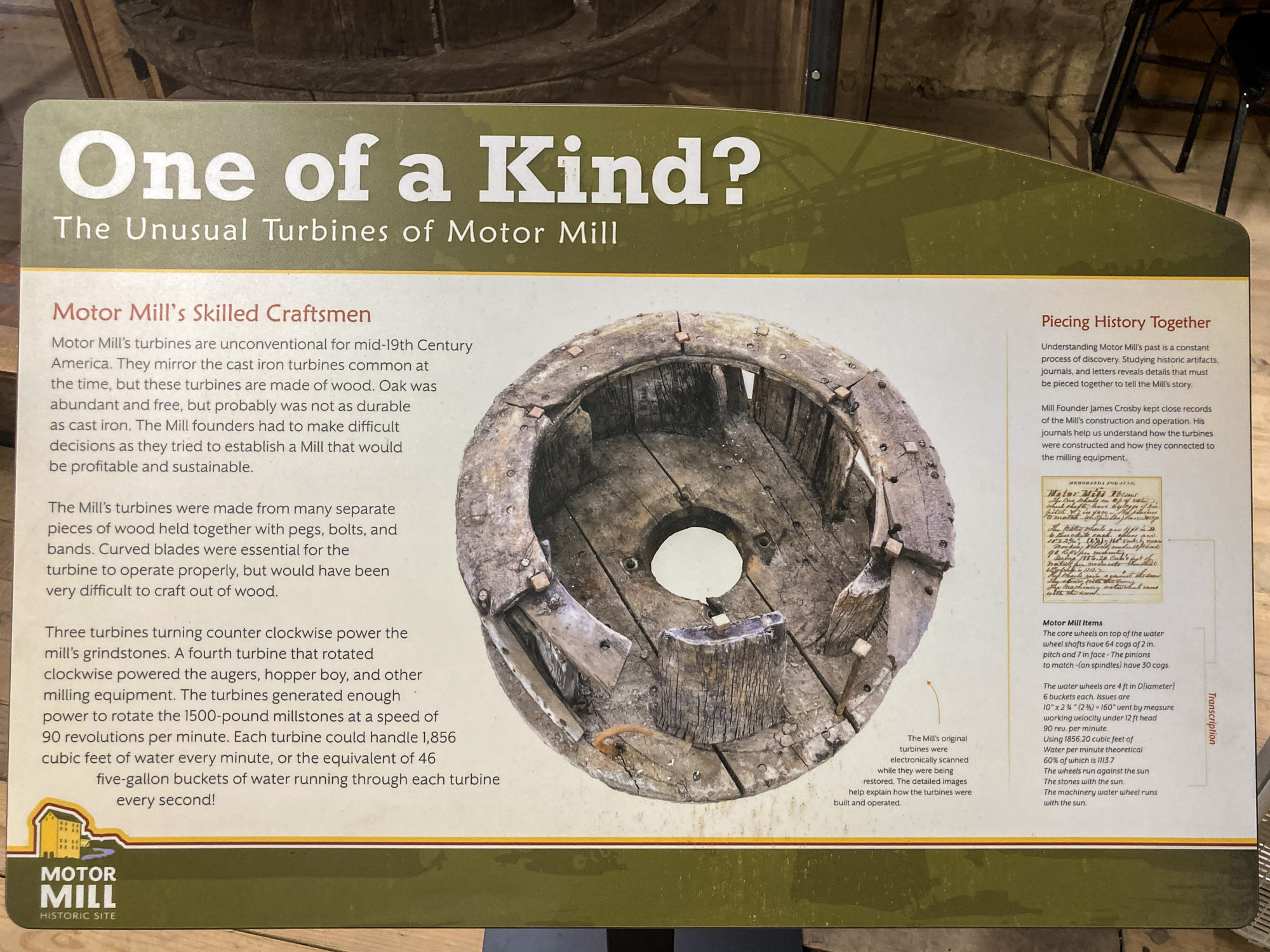
One of the turbines has been preserved and is on display!
Together these four hand-crafted wood turbines developed about 250 horsepower to run all the machinery in the mill!
360 Panoramas
I recently had a chance to walk through the entire Mill with my 360 camera.
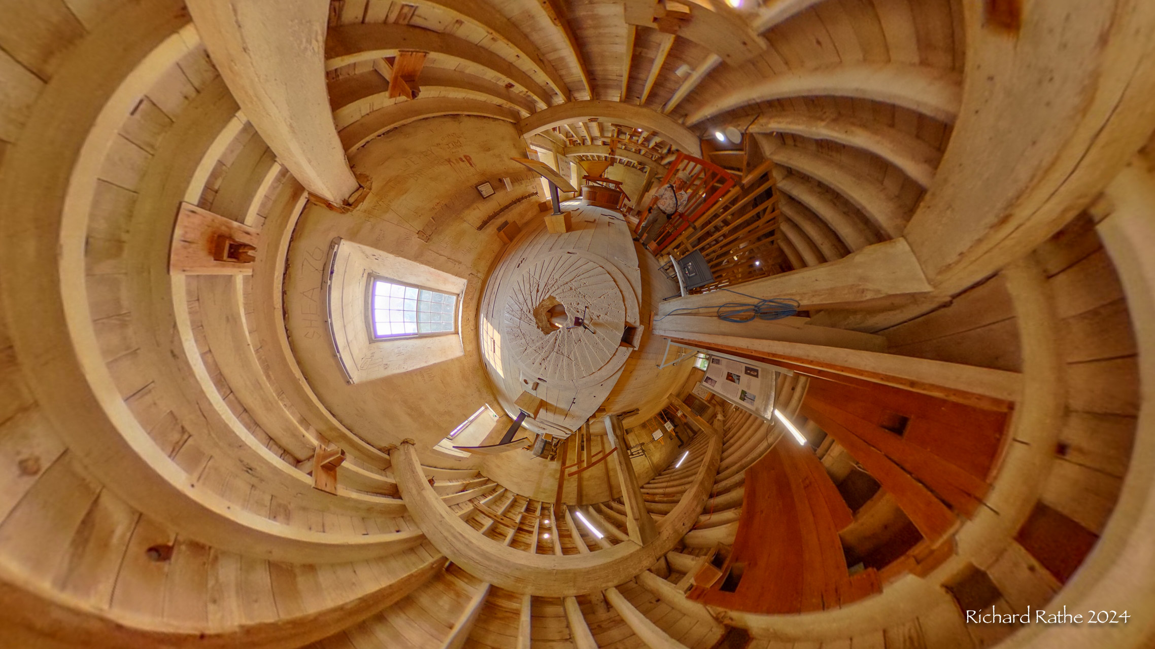
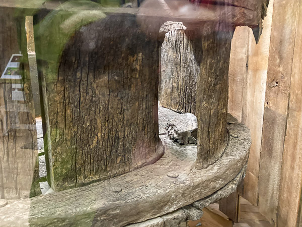
The above “little planet” projection shows one of four mill wheels. Power came from below, turning the top stone (now removed) on the base stone seen here. The grain was fed in from top and the milled product left thru the small opening on the right.
The sort video above shows the raw rectilinear footage followed by a “little planet” rendering of same.
For more info check out the Motor Mill Website!