Okefenokee Canoe Trip 2021

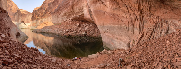
I last traveled to the Okefenokee in 2004, and I had been hoping to return sooner. My return was delayed in part by a multi-year drought and Major Fires in 2011. This year the water was high thanks to record rainfall in the late summer.

Source:USF&WS

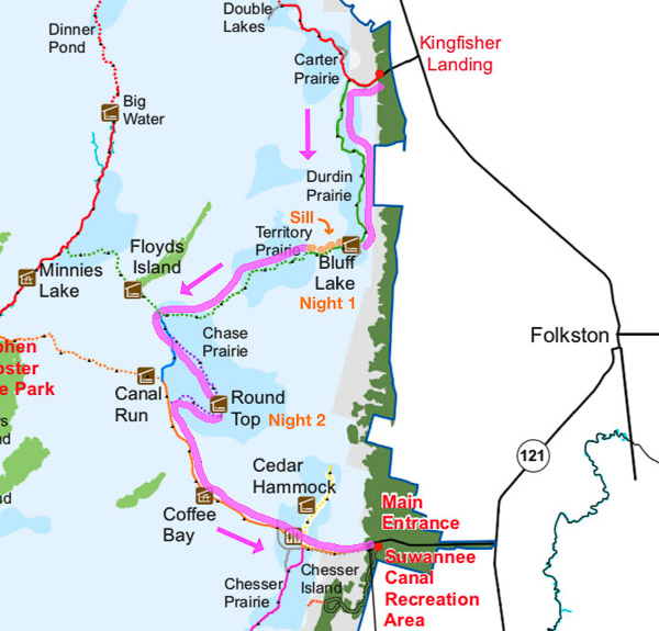
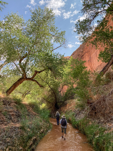
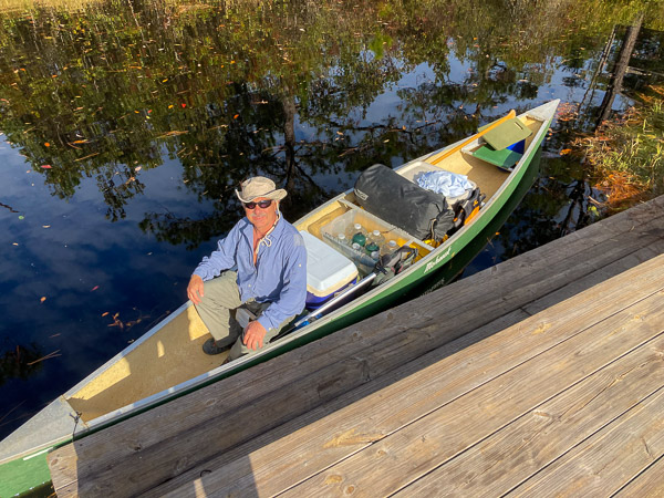
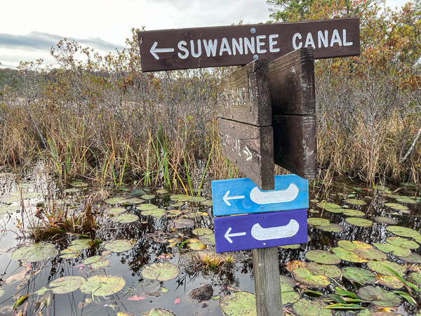
We left our car at the Suwannee Canal entrance and took advantage of a convenient shuttle service to get our canoe and gear up to Kingfisher Landing (about 30 miles north). From there we made our way south via a combination of canals, streams, prairies, sills, and ponds. Click below for an annotated video of our trip…

Starting at Kingfisher Landing

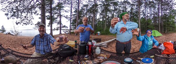
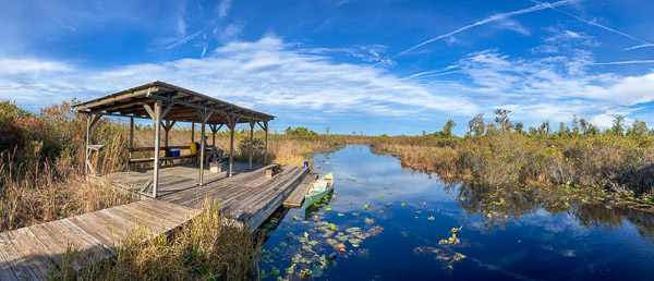
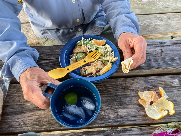
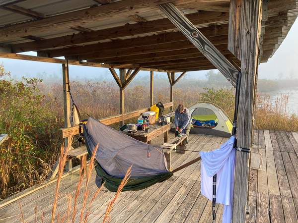
We started by following the Green Trail along a winding series of small canals until we reached our first campsite on the Bluff Lake Chickee. We got there with plenty of time to fix an early dinner and relax.

A Well Marked Trail
Bluff Lake Chickee Panorama
Grilled Chicken Salad for Dinner
Foggy Morning

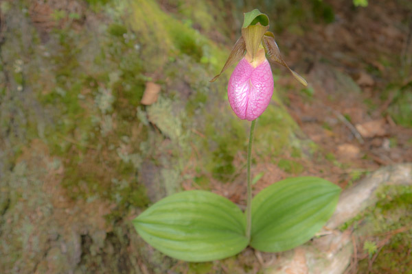
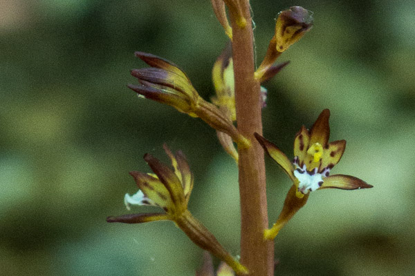
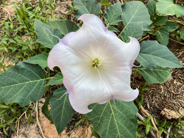
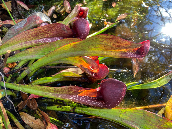
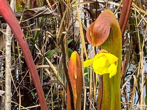
There are several species of carnivorous plants in the swamp, including three pitcher plants. We saw many examples of two of these: the Parrot Pitcher Plant and the Hooded Pitcher Plant. There were many standing dead trees with charred trunks left over from fires a decade ago, but the loss was not total. There were many older living trees interspersed with the dead, and lots of young Bald Cypress trees coming up underneath.

Parrot Pitcher Plant
Hooded Pitcher Plant

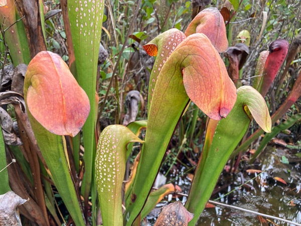
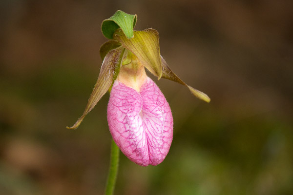
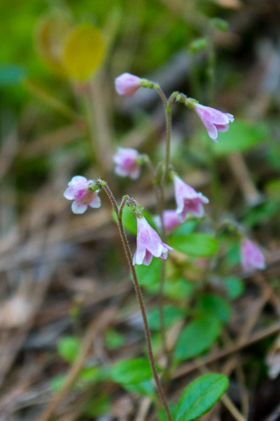
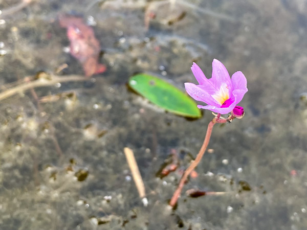
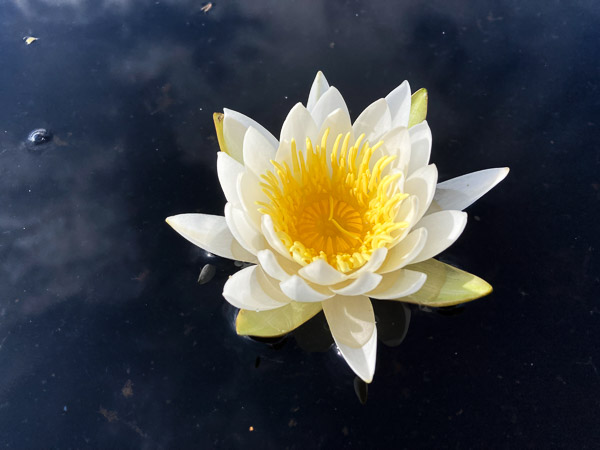
Yellow and Purple Bladderworts were blooming in abundance, occasional white Fragrant Waterlilies, and we even saw one Hooded Pitcher Plant putting up a flower!

Hooded Pitcher Plant in Bloom
Purple Bladderwort (Carnivorous)
Fragrant Waterlily

After a brief time on the connecting Blue Trail we picked up the Purple Trail that loops out into the Chase Prairie and our next chickee.

Crossroads
Ten Foot Gator!

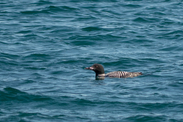
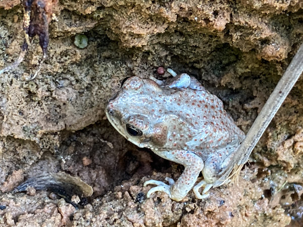
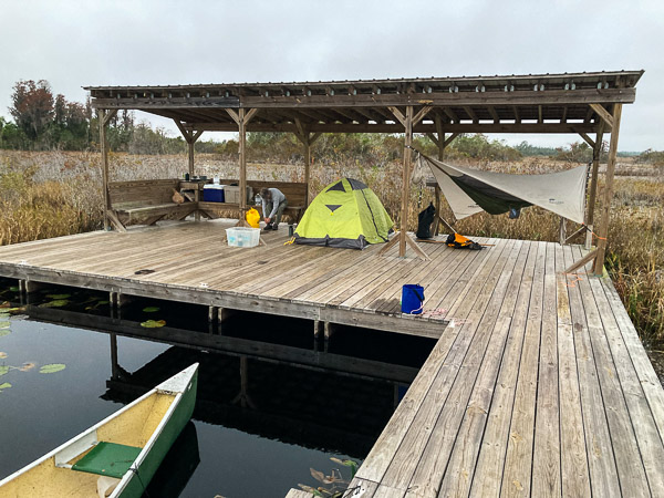
These prairies are a mix of open water, marsh, and small islands with trees. The Round Top Chickee boasts a 360º view of this robust ecology. We saw more birds here including Sandhill Cranes and Egrets. We heard Barred Owls calling all around us in the evening. We got a bit of rain during the night so the morning was grey and damp.

Round Top Chickee
Intrepid Travelers

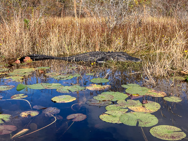
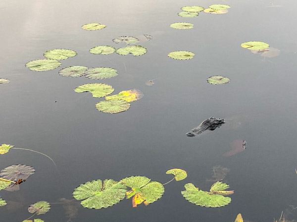
There was a small box for a trail journal on this chickee, but all we found were notes written on toilet paper rolls railing about “Nancy Pelosi”?!

Toilet Paper Message

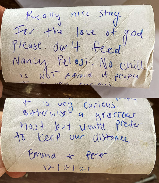
Turns out they were referring to the resident six foot gator who hung about the chickee the entire time we were there. This is likely because earlier visitors had fed it (a very BAD idea!). Gators that remain too close to humans usually lose their lives! Sad.

“Nancy”

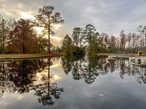
After the overnight drizzle we packed up in the grey dawn and continued on the Purple Trail to the next big intersection. The sun came out as we turned east on the Orange Trail. This is a major canal flowing to the west that got larger and larger as we approached the visitor center. We had lunch on the Coffee Bay platform just before the rain started. About a mile from the take-out it started to pour. By the time we had the gear all packed the late afternoon sun broke through.

Trail’s End

Apostle Islands 2021

Source:NPS

We recently went for a quick trip to Stockton Island in my friend’s new boat. Stockton has the huge advantage of partially sheltered bays with places to tie up the boat. [Full Gallery]

Campsite #19

We made an amphibious landing to offload our gear and then moored the boat about a mile away at the pier (seen in the distance above). I pitched my hammock tent right on the beach between mature white and red pines. The level of Lake Superior had recently gone down so there was a more normal amount of beach exposed.

The highlight of this trip came early, as we took a short walk away from the visitors center and came upon this magnificent orchid, the Pink Lady’s Slipper!

Pink Lady’s Slipper

“In order to survive and reproduce, Pink Lady’s Slipper interacts with a fungus in the soil. Generally, orchid seeds do not have food supplies inside them… The lady’s slipper seeds require threads of fungus to break open and attach to the seed. The fungus will pass on food and nutrients. When the lady’s slipper plant is older… the fungus will extract nutrients from its roots. This mutually beneficial relationship between the orchid and the fungus is known as “symbiosis” and is typical of almost all orchid species.

Pink lady’s slipper takes many years to go from seed to mature plants. Pink lady’s slippers can live to be twenty years old or more…”

www.fs.fed.us

“These plants require bees for pollination. Bees are lured into the flower pouch through the front slit, attracted by the flower’s bright color and sweet scent. Once inside, the bees find no reward, and discover that they are trapped, with only one point of escape. Inside the pouch, there are hairs that lead to a pair of exit openings, one beneath each pollen mass. The bee must pass under the stigma, so if it bears any pollen from a visit to another flower, it will be deposited before picking up a fresh load on the way out.”

There is a reason I’ve never seen one of these flowers before—June is bug season in the north woods. Campers avoid that month. For this trip the breeze from the lake kept the bugs at bay on the beach, but they were pretty aggressive back in the woods.

There were other plants in bloom but it was obviously the end of the season for most…

Twin Flower (Linnaea borealis)
Wintergreen
Marsh Marigold

The nearby campsites were empty so we had a pleasant evening of good food, good drink, & good company!

For our second day we moved around the corner to Quarry Bay near the site of an old brownstone quarry.

Quarry Bay (Campsite #20)

Note the bear locker in the photo above. Much easier than putting the food up in a tree!

I pitched my hammock lower and more securely because thunderstorms were predicted (and came) during the night.

We visited the quarry, which is very impressive but hard to photograph through the trees.

Etched Quarry Wall

I found another tiny orchid along the trail…

Coral Root Orchid

We also saw some critters…

Common Loon
Garter Snake

The next day started windy but it abated somewhat as we made our way back to port in Bayfield. We saw a traditional commercial fishing boat along the way.

Lake Superior Herring Tug

[More Photos…]

Lake Powell & Beyond 2020

Six Night Lake Powell Trip (Click Map to Enlarge)

It had been ten years since I last visited Lake Powell. This year I went with my college friend Al and his partner Marian. [Full Gallery] Not having our own boat, we decided to rent a houseboat from the Bullfrog Marina. This turned out to be a great idea! With a few exceptions it was clean and well maintained (certain lights and the gas grill did not work). The main problem was how late in the day we got started (nominal “check in” time is 10am, we did not leave until after 3pm). For various reasons the day we left was very crowded (COVID19, low water facilitating small boat campers, last big week-end of the summer, etc.)

On Our Way!

In the few hours we had on the first day we headed north to Forgotten Canyon. It was packed with small boats and large groups of people camped on the beaches exposed by the low water level. We retreated and found a small anchorage on a large bend near a side canyon (which we explored by kayak first thing the next day).

Our First Kayak Excursion
Alcove with 100 Foot Dry Waterfall Above

On Day 2 we moved back up the canyon so we could be closer to activities on land. [We were treated both nights to inappropriate music, bad karaoke and loud boat engines. I put in my earbuds and listened to Earth Spirit by R. Carlos Nakai (Native American flute) while sleeping out under the stars.]

Defiance House Petroglyphs

That evening (after most of the day’s heat was gone) we made the first of two visits to the eight hundred year old Defiance House Ruins. These are very well stabilized and open to the public. (Kudos to the Park Service!) The first thing you notice are the large petroglyphs on the canyon wall. There is no ambiguity as to their meaning… three warriors with shields and weapons.

Defiance House Main Structure

The site consists of two major rooms with doors facing in opposite directions. The largest is approximately 8-10 feet on a side. There is a patio beyond the structure with a vertical entrance to the Kiva. (Large Panorama)

Defiance House and Kiva Entrance (Click to Enlarge)
Kiva Ceiling with 800 Year Old Soot from Campfires

We returned the next day (Day 3) and I took some additional 360° panoramas.

Defiance House Ruins (Click to Enlarge)

We then proceeded about two miles up the canyon. We saw many interesting things including ravens, flowers being pollenated (or eaten?) by large black hornets with orange wings, and what I think were three-toed dinosaur tracks!

The day was very hot so we took a siesta near a grove of small oak trees before we headed back to the boat. In spite of my best efforts I got dehydrated. The temp was in the low 90s with very low humidity. It just sucked the water out of me!

On Day 4 we left that area to do more exploring. We ended up in Lake Canyon (which apparently is a very hard place to find anchorage with higher water). It was less crowded and the people were more considerate, which was a plus. We again used our inflatable kayak to explore a side canyon in the late afternoon.

On Day 5 we headed up the main canyon in what turned out to be a delightful wet-boot hike. It was very pleasant to have running water available at all times!

Upper Lake Canyon

There were lots of trees and flowers in bloom. We saw several critters including a toad (red-spotted?) and a bat (dead?). We also passed a small ruins high on the canyon wall.

On Day 6 we again picked up our anchors and moved to Iceberg Canyon with its cyclopean rock walls—Truly Magnificent! Here we finally found some real solitude in our own little side canyon where we swam and relaxed.

Iceberg Canyon Campsite

We took out the kayak and explored the three arms of the upper canyon. We had to maneuver around hundreds of dead trees protruding from the low water.

The south arm has a rockfall that created a separate small lake. Compare with these photos [1] [2] I took in 2010 to see how much lower the water is.

The next day we headed back to Bullfrog and civilization. Click on the video below for clips from each canyon we visited.

Leaving Iceberg Canyon

See the Full Gallery for more photos of petroglyphs, HDR photos, and panoramas–including my lightening tour of nearby parks Goblin Valley, Capital Reef, Grand Staircase-Escalante, and Bryce Canyon. I concluded by crossing the Colorado River at the Glen Canyon Dam (which creates Lake Powell!).