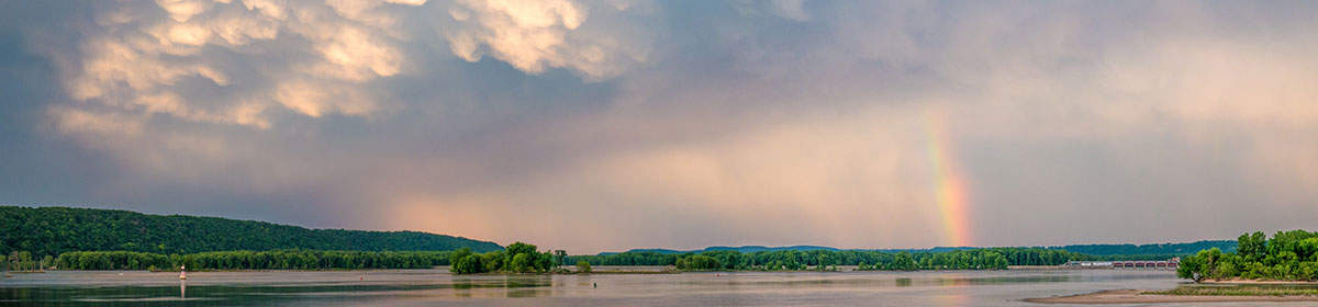
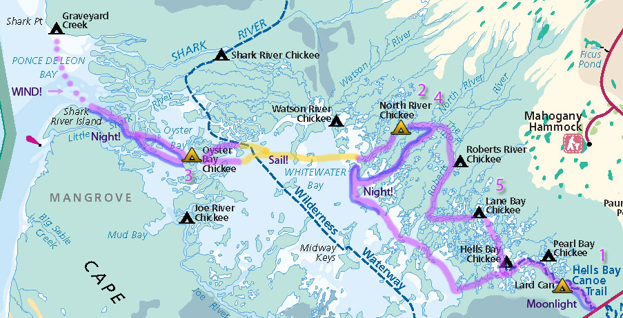
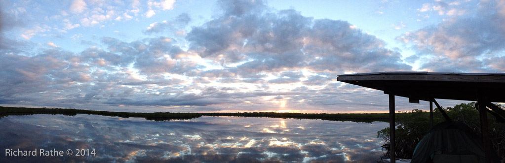
There were many firsts on this trip: First time we drove all the way from North Florida to Flamingo and started the trip in one day. First time we’ve spent a significant amount of time traveling at night. First time we got lost. First time we sailed on Whitewater Bay. First time we declared a weather emergency and did not camp at our designated site. First time we got skunked on more than one campsite. Oyster Bay was closed for repairs and Shark and Watson River Chickees were booked solid. We were so busy I didn’t have much time for photography, but I got a few good shots and panoramas. [gallery]
Larry and I started at the Hells Bay Trailhead just as the sun was setting. It was a full moon and the temperature quickly dropped into the 40’s. This is the one part of the park that has trail markers so navigation was no big deal. We got to Lard Can around 10:30pm only to find an extra party camped there (they were novices who didn’t make it to Pearl Bay). We found the last bit of dry flat ground, put up the tent and went to sleep.
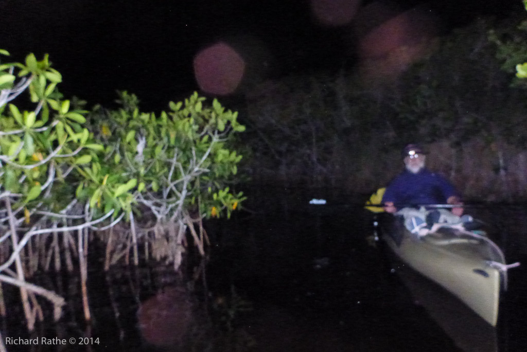
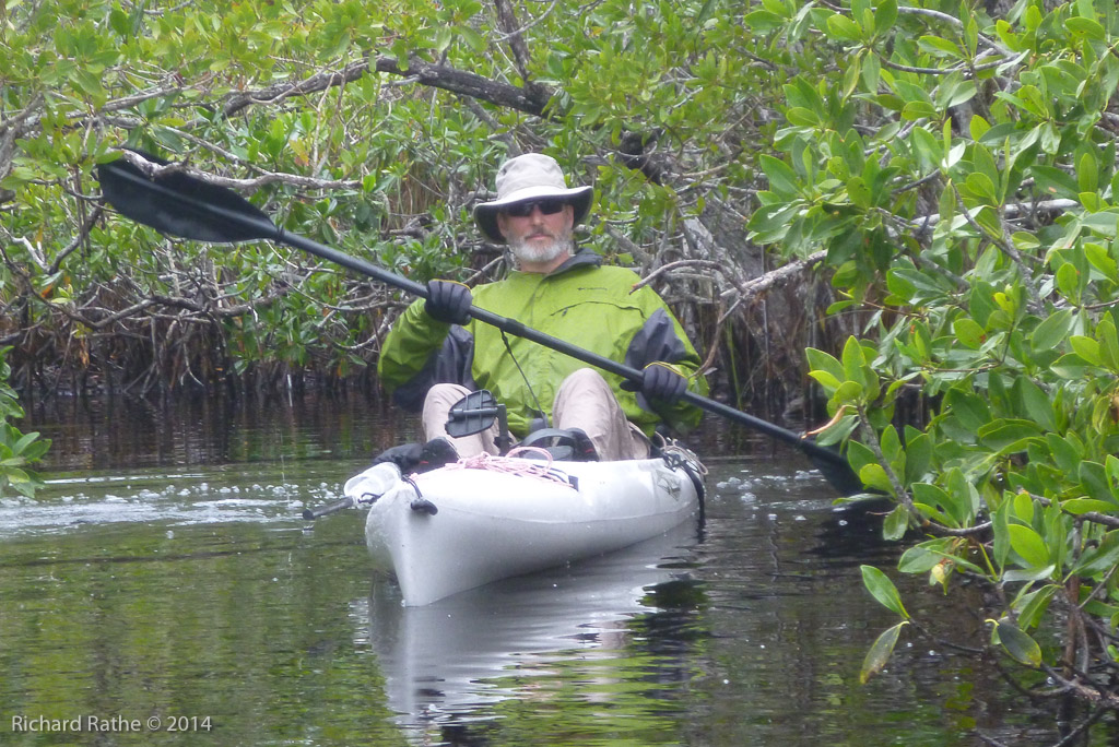
The next day we made it to the Hells Bay Chickee before I realized I had left my sail at the last stop. I pedaled back to retrieve it and this wasted an hour or two complicating our late start. (As a conciliation I did see a Manatee as I crossed Pearl Bay!) We got down to Whitewater Bay late in the afternoon and headed north. My goal was to get into one of the two branches of the North River before it was completely dark. Sadly this was not to be, and it was very dark with no moon by the time we got up there. The compass and map weren’t much use as we poked around in the mangroves. Then we got the idea to turn on Larry’s iPhone. (The GPS part works even when there is no phone service.) I thought I could get longitude and latitude and locate us on the map. It turned out to be easier than I thought it would be, a low-resolution map of the area was still cached in the phone’s memory. There was just enough detail to allow us to see that the river was just around the corner. (What a relief!) After that we pedaled along without incident up to the North River Chickee. Again it was after 10:30 and we went to bed without bothering to cook dinner. (Note: Thinking about it the next day I realized my camera also has GPS, so we could have gotten long/lat from there as well.)
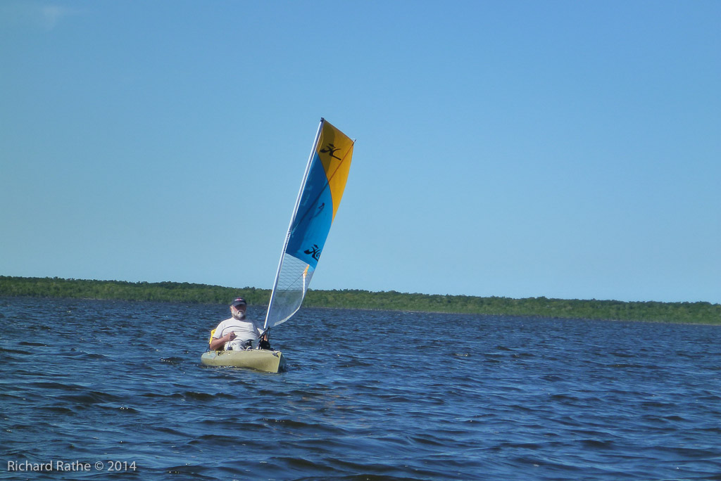
We got up late on the third day to try and synchronize with the tides later in the day. Once we were back in open water we sailed about eight miles across upper Whitewater Bay. This was great of course. We had a rest and ate an impromptu meal on the Oyster Bay Chickee, which had a tent and gear on it from a fishing party. (Little did we know we would see them again!) We then headed down the Shark River with the outgoing tide. This was a good plan, until we came around the last bend and faced a stiff breeze and three foot waves on the Gulf. I had intended to pedal the mile or so across Ponce de León Bay to our campsite near Graveyard Creek, but the water was so rough we did not think it wise to proceed. So we turned around and retraced our route back up the river in the dark. We decided to return to the Oyster Bay Chickee and see if the fishermen would take pity on us.
The current was not as fast as I had feared and the pedal kayaks helped us make good time. At one point we were surrounded by a pod of Dolphins feeding. We could hear them splashing and breathing all around us. I saw a dorsal fin cross three feet in front my bow at one point. Everything turned out well when we finally got there. It was the first day the double chickee was back in service and they were the only party. They helped us get organized and even gave me a beer. We pitched our tent and for the third night we went to bed about 11pm without cooking dinner.
The next day we headed back across the bay. We decided that the opportunity for more sailing and an early arrival outweighed exploration of the small creeks and ponds to the north of Whitewater Bay. (It had been my intention to travel up the northern branches of the Shark River if we had camped at Graveyard Creek.) It was calm when we set out, but a light breeze rose before we got to the halfway point. By the time we got to the other side we had plenty of wind. We kept the sails up as we maneuvered into the mouth of the Northern Fork of the North River (not as easy as it sounds) and proceeded to sail all the way up to the Chickee. We cooked our first hot meal and Larry even had some time to fish.
The fifth day was a breeze. We continued north to the Roberts River Cut Off. (This is one of several lateral connections between rivers in the Everglades, which can be very convenient!) We proceeded down the Roberts River and passed several huge houseboats pulled up at the next Chickee. Seemed a bit unfair since they could throw out an anchor almost anywhere and legally spend the night. The Roberts shares its mouth with the Lane River, so as we rounded the corner we again sailed up river almost to the Lane Bay Chickee by about 2pm. After lunch I took some time to read while Larry went out on the bay to fish. They weren’t biting. After dinner and just at dusk larry took a few casts off the chickee and almost immediately hooked a Ladyfish. Apparently this species is not very good to eat, but lots of fun to catch and release, which he proceeded to do for the next twenty minutes or so. One of them even jumped in his kayak!
On the final day we got up early and headed back down to Hells Bay. On the way we passed what must have been a group of Outward Bound campers who were bivouacked on top of their canoes back in the mangrove. We got back to our car about noon and just as we were tying the kayaks down, it started to rain. We changed into dry clothes in a fast food restroom before heading up the turnpike and home. I was destined to repeat the journey the next day for a second trip with my cousins.