Everglades Sail Kayak Trip 2014

everglades-route-south-2014

There were many firsts on this trip: First time we drove all the way from North Florida to Flamingo and started the trip in one day. First time we’ve spent a significant amount of time traveling at night. First time we got lost. First time we sailed on Whitewater Bay. First time we declared a weather emergency and did not camp at our designated site. First time we got skunked on more than one campsite. Oyster Bay was closed for repairs and Shark and Watson River Chickees were booked solid. We were so busy I didn’t have much time for photography, but I got a few good shots and panoramas. [gallery]

mangroves-in-moonlight

Larry and I started at the Hells Bay Trailhead just as the sun was setting. It was a full moon and the temperature quickly dropped into the 40’s. This is the one part of the park that has trail markers so navigation was no big deal. We got to Lard Can around 10:30pm only to find an extra party camped there (they were novices who didn’t make it to Pearl Bay). We found the last bit of dry flat ground, put up the tent and went to sleep.

The next day we made it to the Hells Bay Chickee before I realized I had left my sail at the last stop. I pedaled back to retrieve it and this wasted an hour or two complicating our late start. (As a conciliation I did see a Manatee as I crossed Pearl Bay!) We got down to Whitewater Bay late in the afternoon and headed north. My goal was to get into one of the two branches of the North River before it was completely dark. Sadly this was not to be, and it was very dark with no moon by the time we got up there. The compass and map weren’t much use as we poked around in the mangroves. Then we got the idea to turn on Larry’s iPhone. (The GPS part works even when there is no phone service.) I thought I could get longitude and latitude and locate us on the map. It turned out to be easier than I thought it would be, a low-resolution map of the area was still cached in the phone’s memory. There was just enough detail to allow us to see that the river was just around the corner. (What a relief!) After that we pedaled along without incident up to the North River Chickee. Again it was after 10:30 and we went to bed without bothering to cook dinner. (Note: Thinking about it the next day I realized my camera also has GPS, so we could have gotten long/lat from there as well.)

sailing-whitewater-bay

We got up late on the third day to try and synchronize with the tides later in the day. Once we were back in open water we sailed about eight miles across upper Whitewater Bay. This was great of course. We had a rest and ate an impromptu meal on the Oyster Bay Chickee, which had a tent and gear on it from a fishing party. (Little did we know we would see them again!) We then headed down the Shark River with the outgoing tide. This was a good plan, until we came around the last bend and faced a stiff breeze and three foot waves on the Gulf. I had intended to pedal the mile or so across Ponce de León Bay to our campsite near Graveyard Creek, but the water was so rough we did not think it wise to proceed. So we turned around and retraced our route back up the river in the dark. We decided to return to the Oyster Bay Chickee and see if the fishermen would take pity on us.

The current was not as fast as I had feared and the pedal kayaks helped us make good time. At one point we were surrounded by a pod of Dolphins feeding. We could hear them splashing and breathing all around us. I saw a dorsal fin cross three feet in front my bow at one point. Everything turned out well when we finally got there. It was the first day the double chickee was back in service and they were the only party. They helped us get organized and even gave me a beer. We pitched our tent and for the third night we went to bed about 11pm without cooking dinner.

The next day we headed back across the bay. We decided that the opportunity for more sailing and an early arrival outweighed exploration of the small creeks and ponds to the north of Whitewater Bay. (It had been my intention to travel up the northern branches of the Shark River if we had camped at Graveyard Creek.) It was calm when we set out, but a light breeze rose before we got to the halfway point. By the time we got to the other side we had plenty of wind. We kept the sails up as we maneuvered into the mouth of the Northern Fork of the North River (not as easy as it sounds) and proceeded to sail all the way up to the Chickee. We cooked our first hot meal and Larry even had some time to fish.

sunrise-north-river-pano

The fifth day was a breeze. We continued north to the Roberts River Cut Off. (This is one of several lateral connections between rivers in the Everglades, which can be very convenient!) We proceeded down the Roberts River and passed several huge houseboats pulled up at the next Chickee. Seemed a bit unfair since they could throw out an anchor almost anywhere and legally spend the night. The Roberts shares its mouth with the Lane River, so as we rounded the corner we again sailed up river almost to the Lane Bay Chickee by about 2pm. After lunch I took some time to read while Larry went out on the bay to fish. They weren’t biting. After dinner and just at dusk larry took a few casts off the chickee and almost immediately hooked a Ladyfish. Apparently this species is not very good to eat, but lots of fun to catch and release, which he proceeded to do for the next twenty minutes or so. One of them even jumped in his kayak!

richard-in-the-mangroves

On the final day we got up early and headed back down to Hells Bay. On the way we passed what must have been a group of Outward Bound campers who were bivouacked on top of their canoes back in the mangrove. We got back to our car about noon and just as we were tying the kayaks down, it started to rain. We changed into dry clothes in a fast food restroom before heading up the turnpike and home. I was destined to repeat the journey the next day for a second trip with my cousins.

Galapagos Islands 2013

Galapagos Map

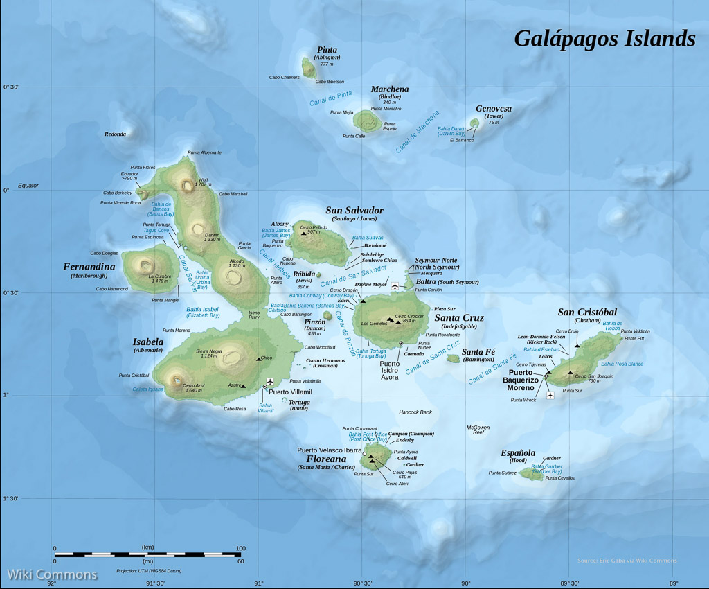
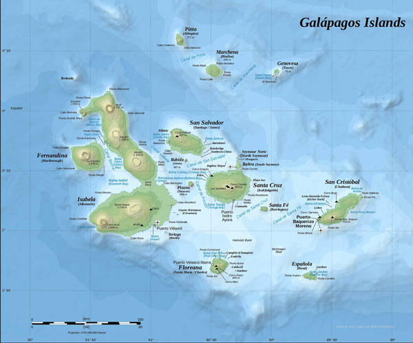
We recently visited Ecuador and the Galapagos Islands. After many hours of editing the first complete Gallery of Photos is ready. I will add to this post periodically. Here is my overview of selected highlights…

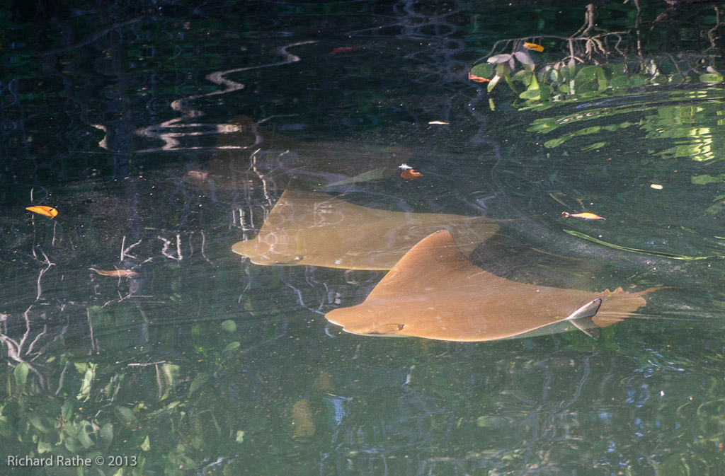
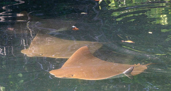
We arrived about noon and proceeded to nearby Black Turtle Bay where we saw Sea Turtles, Sharks, and Golden Rays amongst the mangroves. If you have enough bandwidth you should also view the 12 Minute Video I’ve prepared to see them in motion!

Golden Rays in Black Turtle Bay

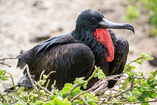
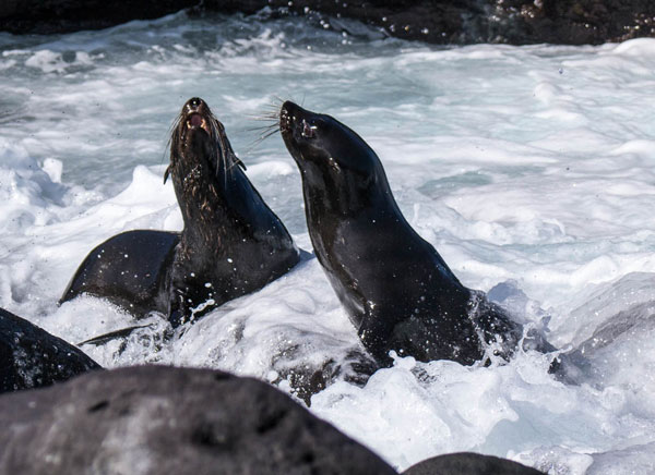
After an overnight cruise we awoke the next day anchored in Darwin Bay on Genovesa Island (basically the flooded caldera of an extinct volcano!). After a wet landing on a sandy beach we had our first encounters with Sea Lions and nesting Frigate Birds. (With many, many more to come!)

Galapagos Frigate Bird

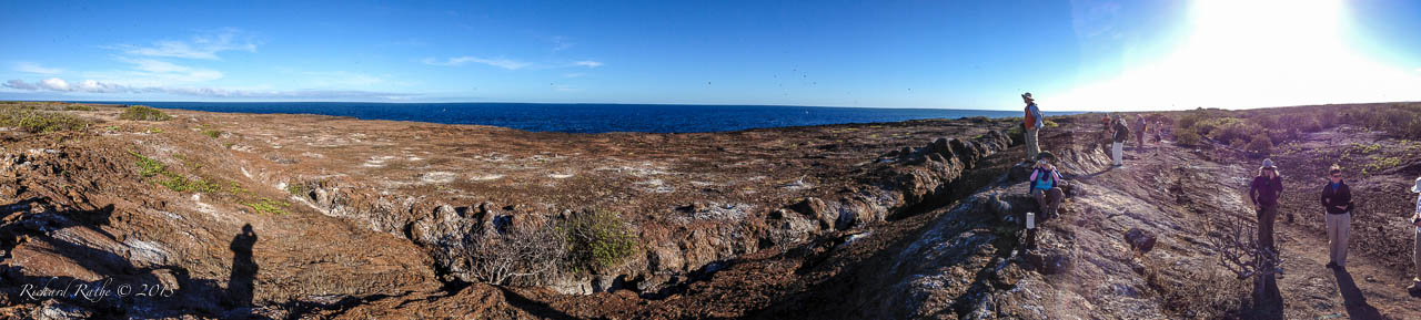
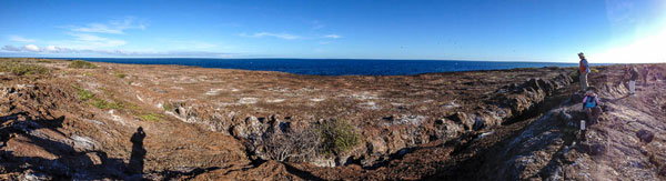
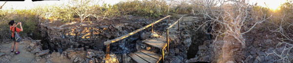
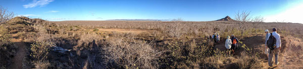
After snorkeling and lunch we climbed a narrow stairway to reach the top of the island. Over one million birds nest here according to our guide. We saw thousands of Petrels, Shearwaters, Frigate Birds, and Boobies in the air and on their nests. We also saw their top predator, the Short-Eared Owl. [I should note that the panoramas below were taken with my iPhone 4s, which did a remarkable job under the circumstances! See Video to get a feel for the thousands of birds flying overhead!]

Galapagos Genovesa Island Galapagos Genovesa Island Steps

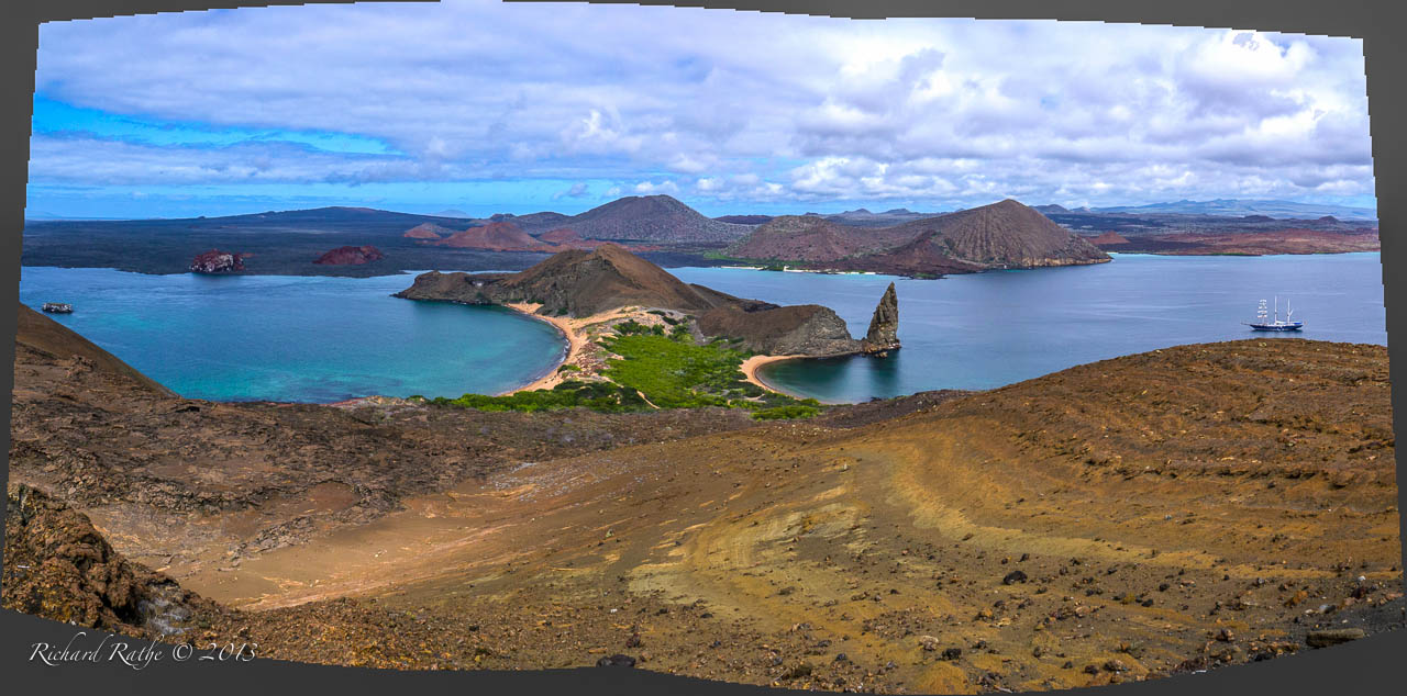
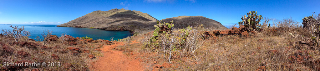
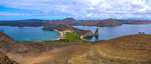
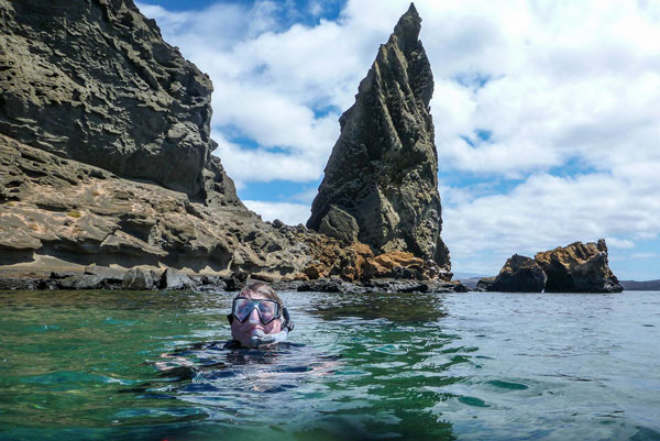
We again cruised overnight and woke up anchored in Sullivan Bay near the iconic Pinnacle Rock of Bartolomé Island. The landscape is stark and strangely beautiful almost beyond words. We first climbed to the Bartolomé summit for one of the most famous views in all of the Galápagos. We were standing on an old cinder cone almost completely barren of plants. In the near distance was the pinnacle and our barkentine sailboat the Mary Anne. Beyond a narrow channel was Santiago Island with black lava flows and red rock outcrops. Spectacular!!

HDR Panorama of Sullivan Bay from the Peak of Bartolomé Island

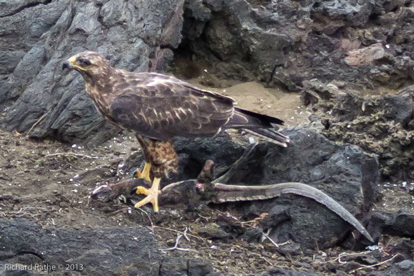
On the ascent I spotted a Galápagos Hawk feeding on an iguana…

Galápagos Hawk

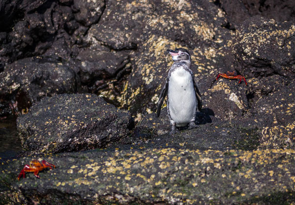
We then took a snorkel around the pinnacle and came across Galápagos Penquins sunning themselves on the rocks…

Galapagos Mark Snorkel

Galapagos Penguin

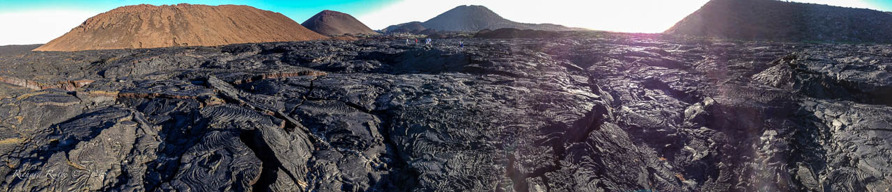
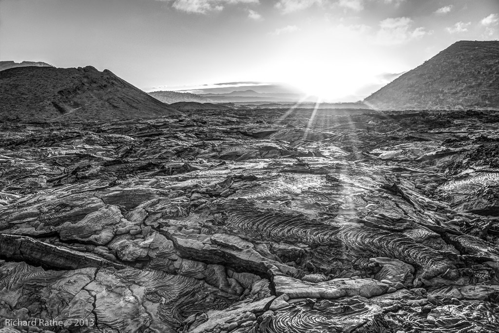
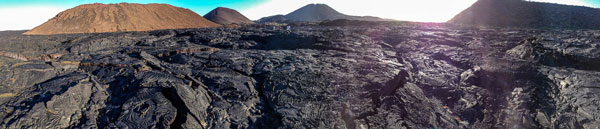
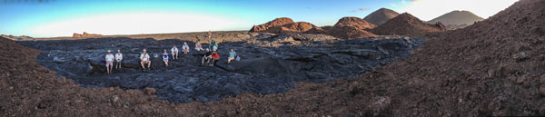
After lunch we crossed the narrow passage and landed on Santiago Island at the site of extensive lava flows dating from the 1800s. We walked for more than two miles over black Pāhoehoe Lava with endless patterns, swirls and cracks.

Galapagos Lava Pano1 Galapagos Lava Pano2

Galapagos Lava Sunset

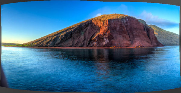
The next day we arrived at Rábida Island with its prominent red cliff and red sand beach. We took an extended dingy ride along the coast (to the right in the photo below). The hillsides were covered with dormant Sandalwood Trees and Prickly Pear (Opuntia) Cactus. [See Video]

Galapagos Rabida Island

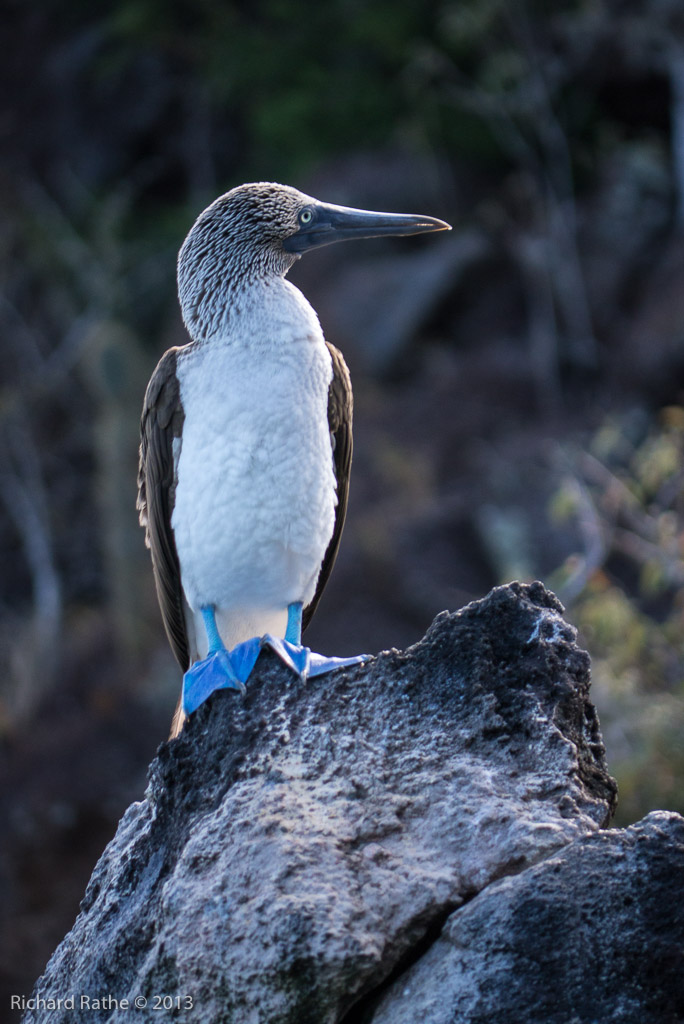
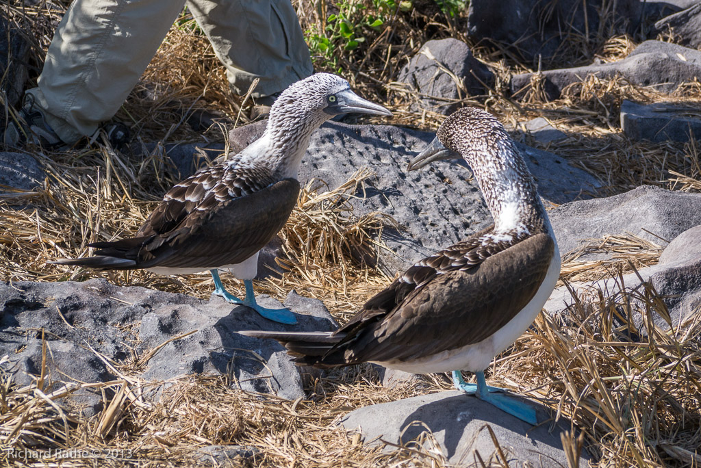
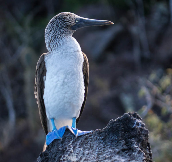
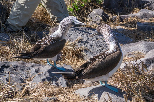
This was our first encounter with the quintessential Blue-Footed Boobie, a magnificent bird! There were also Marine Iguanas, Sally Lightfoot Crabs and Sea Lions playing in the surf.

Galapagos Blue-Footed Boobie

We went for a hike around a point overlooking a blue water bay, and then went snorkeling.

Galapagos Rabida Island Panorama

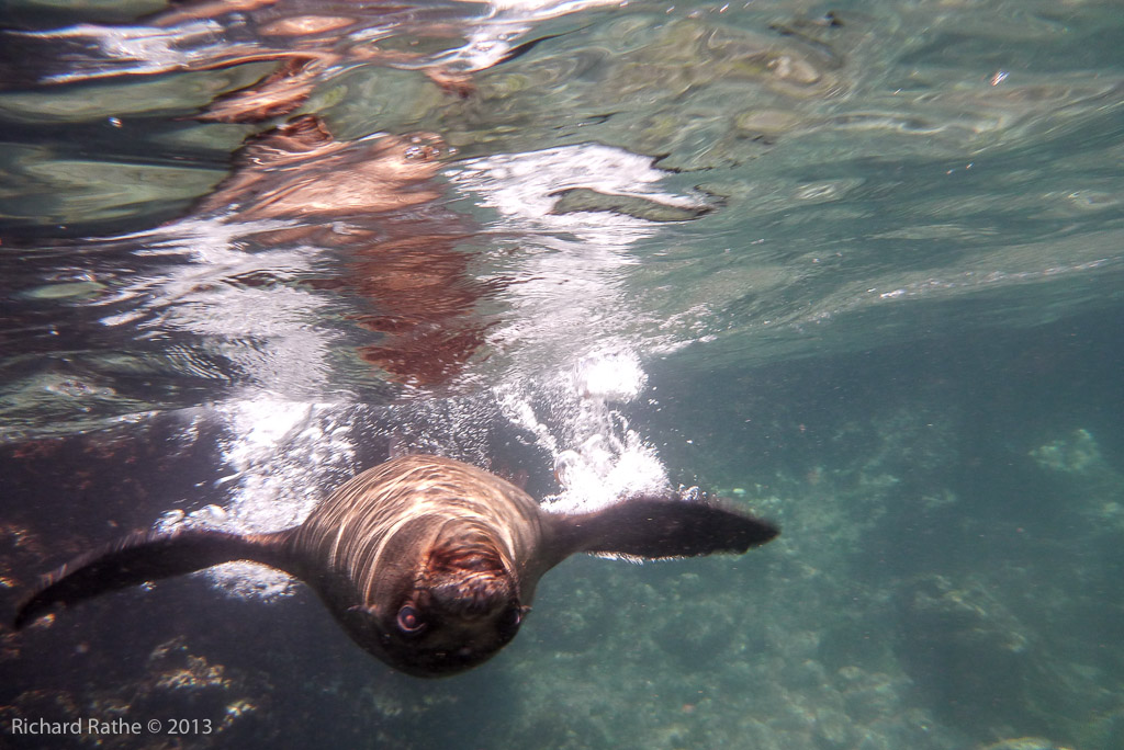
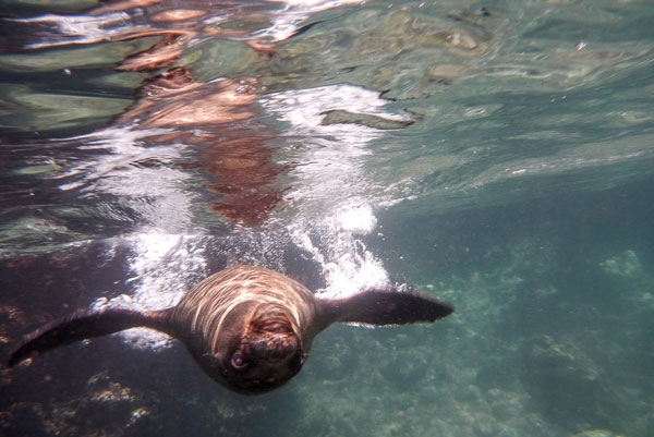
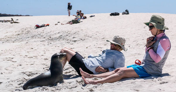
Several Sea Lion Pups decided we were good targets for playing chicken! [See Video]

Galapagos Sea Lion Pup Playing Chicken

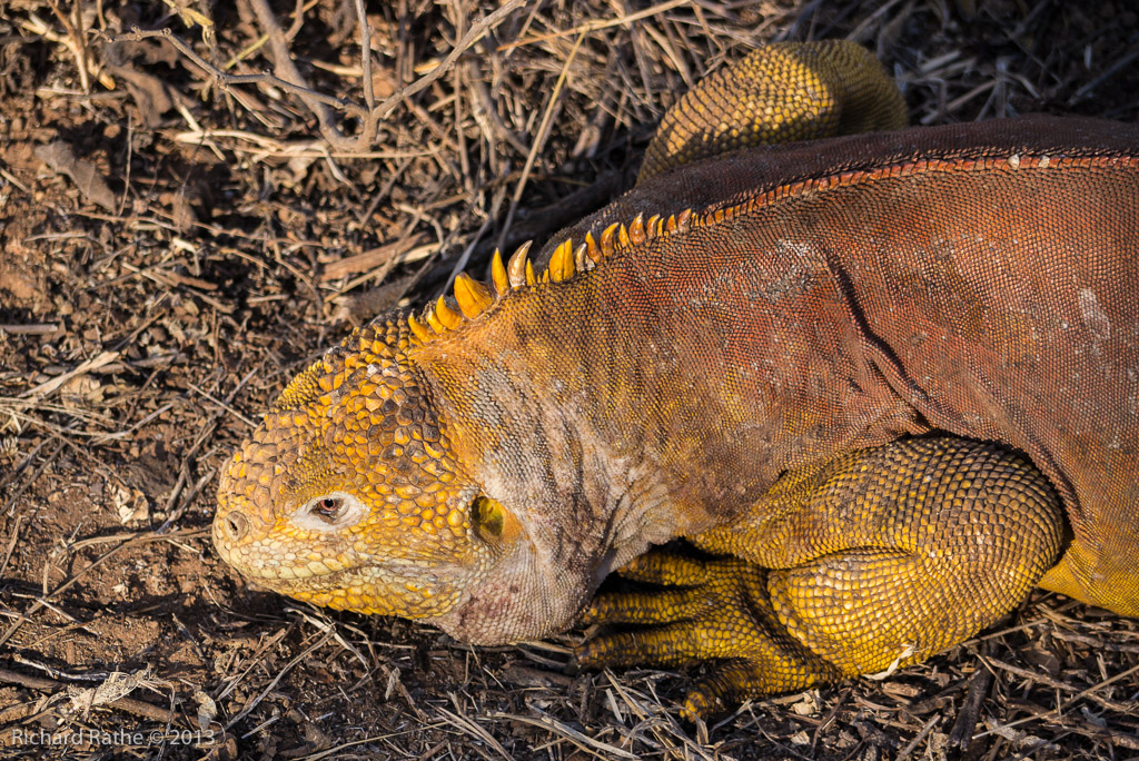
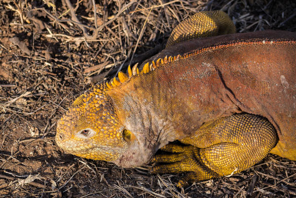
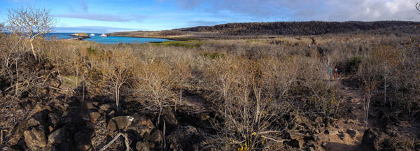
In the afternoon we landed at a point called Cerro Dragón.

Galapagos Cerro Dragon

Galapagos Cerro Dragon Panorama

The “dragons” in this case are large yellow Land Iguanas. We also encountered a lovely Large-Billed Flycatcher. It was so unafraid it landed on a branch about four feet from me!

Galapagos Land Iguana

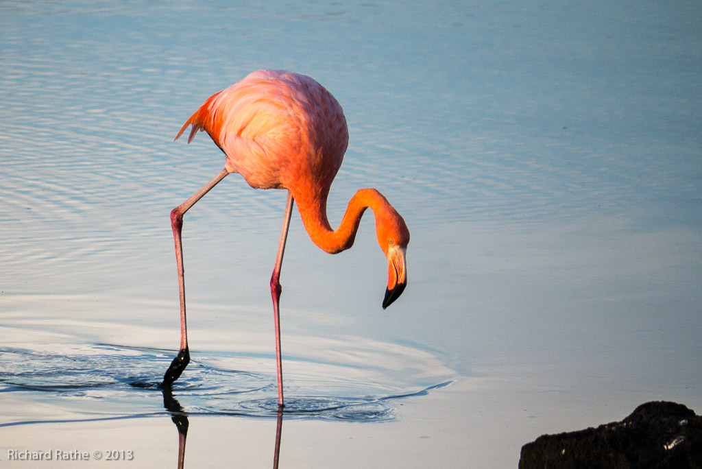
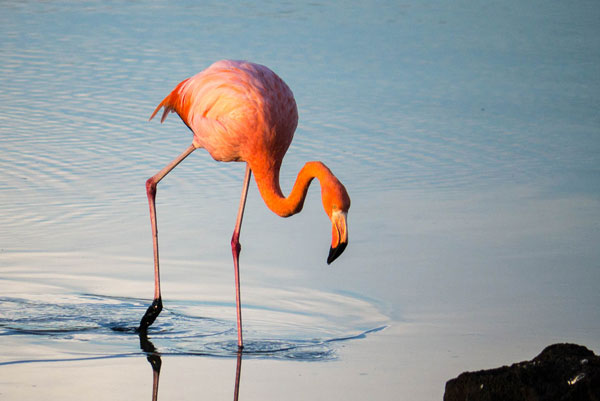
As the sun got low in the west we encountered a pair of Flamingos busily feeding in a small lagoon.  [See Video]

Galapagos Flamingo

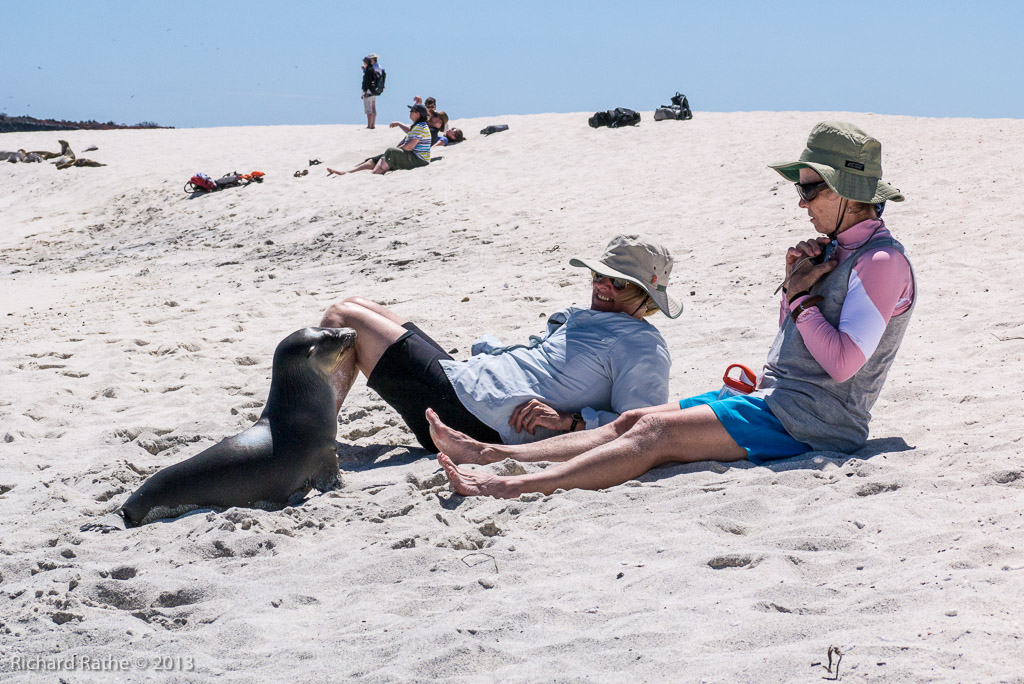
The next day we spent traveling around in the dingy, cruising the coastline and landing on a small island called Mosquera, which is a sea lion resort!  [See Video]

Galapagos Mosquera Friendly Sea Lion Pup

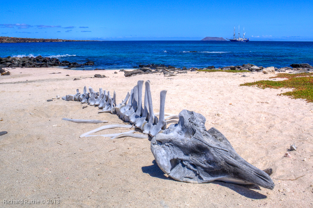
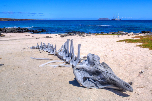
Someone had gathered the bones of a small Beaked Whale and assembled them on the beach.

Galapagos Mosquera Whale Skeleton

Next day we moved down the coast of Santa Cruz and landed on the small South Plaza Island. This is a wildlife and photographic paradise! Sea Lions, Marine and Land Iguanas, Cactus Finches, Mocking Birds, Swallow-Tailed Gulls… you name it!

Galapagos South Plaza Island

Galapagos Sea Lion Pup

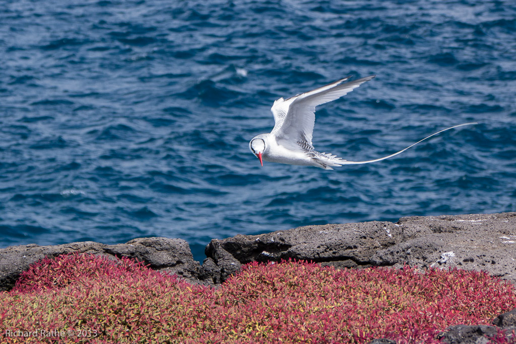
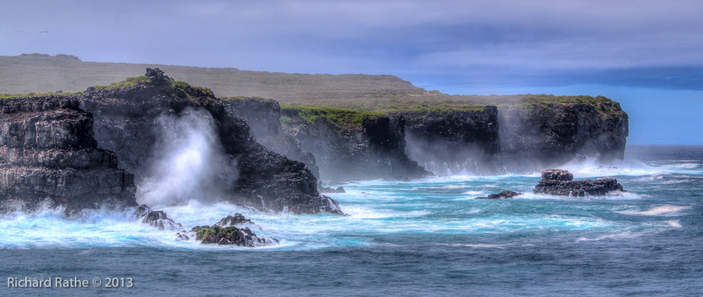
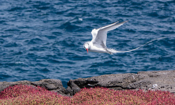
The island gently slopes from a shoreline to a forty foot cliff. There we saw several Red-Billed Tropicbirds as they flew in the updrafts close to the cliff edge.

Galapagos Red-Billed Tropicbird

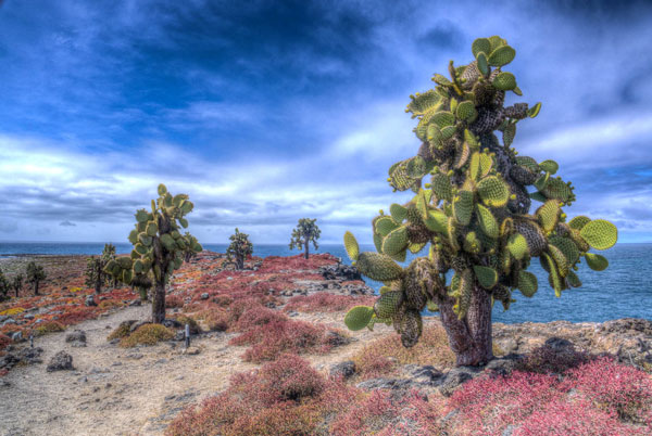
That afternoon we proceeded south to Santa Fé Island for a different species of Land Iguana, Tree-Sized Cactus and a large Sea Lion Colony.

Galapagos Santa Fe Pano

Our final day on the water brought us to Española Island with its high cliffs and unique residents.

Galapagos Espanola Island

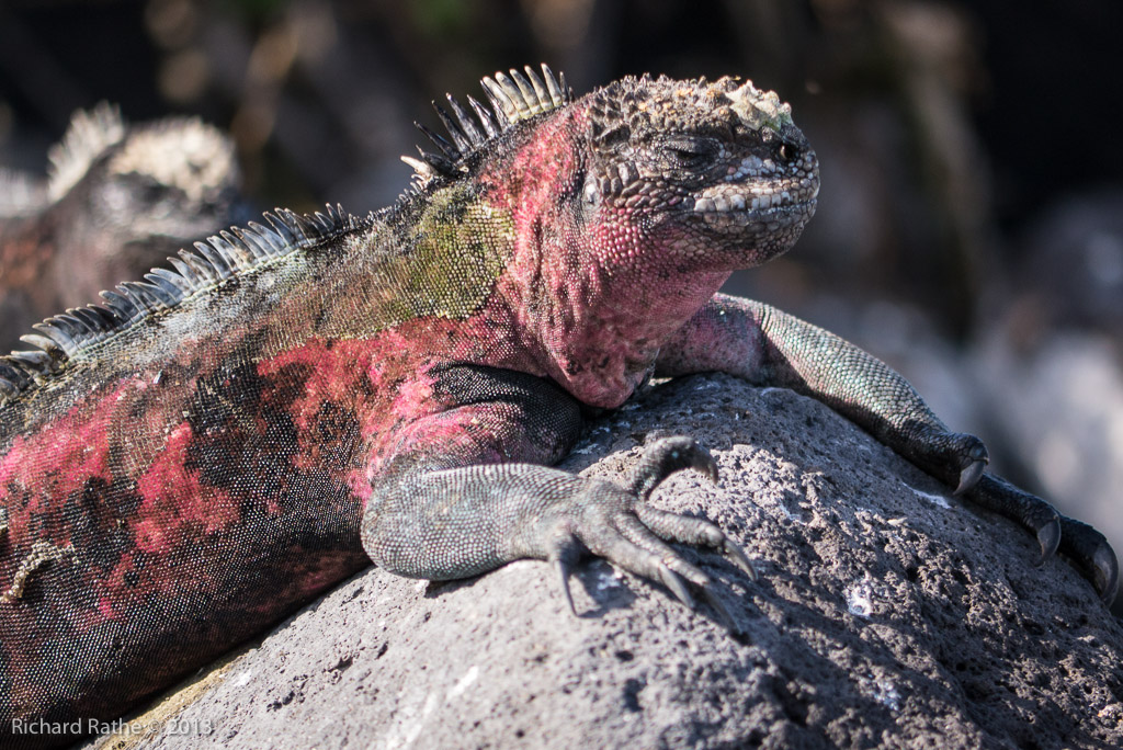
The Marine Iguanas were the most colorful we’d seen…

Galapagos Marine Iguana

A pair of Blue-Footed Boobies did their courtship dance on the trail as we walked past…

Galapagos Blue-Footed Boobie Courtship

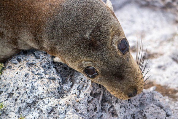
Young Fur Sea Lions cavorted in the surf…

Galapagos Fur Sea Lions

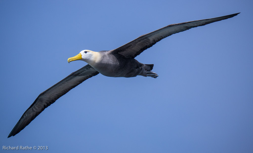
And finally the Waved Albatross courting and nesting along the trail… [See Video]

galapagos-waved-albatross

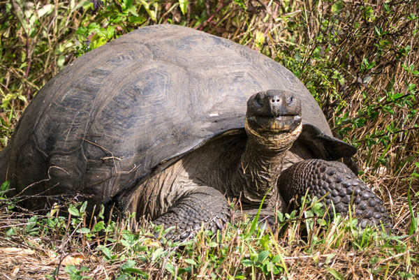
The next day we got in a van and drove through the Santa Cruz Highlands back to the airport. Along the way we had the opportunity to visit a water hole with several Giant Tortoises lounging in it. A perfect coda to an outstanding trip!

Galapagos Giant Tortoise

Everglades (Sail) Kayak Trip 2013

Just back from the Everglades with highlights too numerous to relate them all here. For a start I think we’ve hit on the perfect mode of transportation—pedal kayaks with sails! The only downside compared with a canoe is getting on/off the chickees. In every other respect they were superior to canoes and even other types of kayaks. We especially noticed how wind and waves were much less of the threat, and wind could often be put to good use! Unlike the sail canoe rig I’ve used in the past, the kayaks are much safer if they capsize.

Our route was aggressive and included a passage through Gopher Key, which is only possible at high tide. As you can see, we made extensive use of the sails with a prevailing winds from the north and northeast.

everglades-route-2013-small

I also tried a waterproof camera for the first time with good results, especially video! I’ve edited the clips together into a seven minute long high res feature. Be sure to click on the ‘full screen’ button if available!

Everglades Kayak Trip 2013
201 Mb Video

It was a joy to be able to keep a camera close at hand and not worry about getting it wet. I also got a few good bird and HDR shots with my other cameras [full gallery], but my photography time was limited because we were having too much fun just exploring! Here are a few highlights…

crooked-creek-chickee

First day we stayed at the new Crooked Creek Chickee near the head of the Lopez River. In spite of being just off the main channel the site has a secluded feel. It replaces the now defunct chickee on Sunday Bay (which we will miss!). The new chickee is nice with a few new features: high flat roofs, robust ladders, and elevated kitchen shelves.

kayak-sailing-gulf-of-mexico

The next day we sailed for the first time on the large bays along the way to the Plate Creek Chickee. We were excited to return to this historical location that existed before there was a national park. Alas, the original chickee has been razed and replaced by a new one set away from the small island. Another old place we will miss.

We sailed almost the entire next day. It was phenomenal!! Check out the video above to share some of the thrill. Unfortunately, in the heat of the moment getting the sails up, I lost track of my paddle. <frown> It was on a leash trailing behind as the boat took off and the leash failed due to our excessive speed. Ironically this occurred on the upper Lostmans River. Out in the Gulf of Mexico we sailed about a mile off-shore and reached New Turkey Key with plenty of time to explore and take pictures. Along the way I cut a black mangrove pole to replace my paddle. It worked remarkably well!

new-turkey-key-hdr

new-turkey-key-campsite

The next day we waited for the tide to start rising before heading up Charley Creek to reach Gopher Key. This is a magical place with birds everywhere! My conservative estimate is we saw over four hundred White Pelicans soaring, landing and fishing. No Avocets this time, but there were hundreds of small shore birds feeding and about a dozen Roseate Spoonbills. At one point we witnessed an (unsuccessful) attack from a Peregrine Falcon. It only lasted 20-30 seconds, but the ensuing pandemonium was a sight to behold! The falcon flew right over our heads as he left the scene with empty talons.

charleys-creek-low-bridge

We had an uneventful exit via Gopher Key Creek and pedaled up to the Sweetwater Chickee. We got out early the next day and caught the end of the outgoing tide to get quickly down to The Watson Place. While there we took the now canonical photo by the sugarcane caldron. We made our way down the lower Chatham River and out to the Gulf. We rested at the river mouth and watched a pair of Dolphins feeding on the incoming tide. On the way we saw or heard several Manatees coming up to breathe.

We got to sail some more on our way to Rabbit Key and our last night on the beach. Along the way we saw more White Pelicans and at least three Sea Turtles. I’m convinced that pedaling and sailing are much better than paddling for seeing wildlife. Waving your arms in the air is probably a bit more threatening. We again arrived with plenty of time to explore and had a small beach fire to keep the bugs away in the evening.

The next day we pedaled our way to Sandfly Pass and back to the Ranger Station. All and all this was an exceptional trip and I am completely enamored with the multi-power Kayaks! We found that we could avoid damaging the drive fins by judicious choice of route. Wind and waves were much less of a problem and even became our ally when we put up the sails!

end-of-the-trail